


The Top 10 Places to Hike in Colorado
- andrewmurraywriter

- Aug 5, 2015
- 6 min read
Updated: Jun 15, 2019
Stuck for something to do this weekend? Get your hike on with this guide to the 10 best walking trails on Denver’s doorstep…
1. Boulder County: Longs Peak

The Boulder County Longs Peak trail
Activity Type: HikingNearby City: Estes ParkLength: 14 total milesElevation Gain: 5,255 feetTrail Type: Out-and-backSkill Level: StrenuousSeason: August - SeptemberTrailhead Elevation: 9,400 feetTop Elevation: 14,255 feetLocal Maps: USGS Longs Peak (recommended), DeLorme p. 20, Trails Illustrated #200, national park mapsThe northernmost fourteener in the Rocky Mountains and the highest point in Boulder County and Rocky Mountain National Park, Longs Peak is deservedly the most famous Colorado route. The Keyhole Route is a classic class 3 climb, providing a 15 mile round trip with 5000′ elevation gain. Note that the summit can get quite crowded on summer weekends.
Driving Directions [Google Maps] Click for Interactive Map

2. The Canyon Loop Trail

The Canyon Loop Trail
Activity Type: Hiking Nearby City: Boulder Length: 1.4 total miles Elevation Gain: Minimal Trail Type: Out-and-back Skill Level: Easy Duration: 1 hour Season: Year-round Other Uses: Equestrians, mountain bikers, anglers Local Contacts: Walden Ponds Wildlife Habitat Local Maps: USGS Niwot; map in the brochure available at the trailhead and online at www.bouldercounty .org/openspace/recreating/public_parks/parks_pdfs/WaldenPonds.pdf
The Walden Ponds, in the vicinity of Boulder, are former stone quarry pits converted into wildlife habitats and now popular with anglers, joggers and walkers. This is a gentle 1.4 mile route providing very pleasant wetland scenery, provided you keep your gaze turned in towards the waters and not out towards the surrounding suburbs.
Driving Directions [Google Maps] Click for Interactive Map

3. The Arapaho Pass Trail to Lake Dorothy

The Arapaho Pass Trail to Lake Dorothy
Activity Type:     Hiking
Nearby City:     Nederland
Length:     6.4 total miles
Elevation Gain:     2,000 feet
Trail Type:     Out-and-back
Skill Level:     Moderate to strenuous
Season:     Best June to October
Trailhead Elevation:     10,200 feet
Top Elevation:     12,200 feet
Other Uses:     Fishing
Local Contacts:     Boulder Ranger District, USDA Forest Service
Local Maps:     Trails Illustrated Indian Peaks / Gold Hill, #102
The day hike up the Arapaho Pass Trail to Lake Dorothy is one of the region’s best routes for viewing wildflowers. From the Fourth of July Trailhead, the Trail ascends the northern slope of the North Fork, Middle Boulder Creek drainage into the Indian Peaks Wilderness. The adjoining Caribou Pass Trail takes you westwards to Lake Dorothy and provides remarkable views of open tundra. Note that the lower portion of the trail can get very busy on summer weekends.
Driving Directions [Google Maps] Click for Interactive Map

4. Lake County: Mount Elbert

Mount Elbert
Activity Type:     Hiking
Nearby City:     Leadville
Length:     8.6 total miles
Elevation Gain:     4,423 feet
Trail Type:     Out-and-back
Skill Level:     Strenuous
Season:     July - September
Trailhead Elevation:     10,010 feet
Top Elevation:     14,433 feet
Local Maps:     USGS Mount Elbert (required) and Mount Massive (recommended), DeLorme p. 47, Trails Illustrated #127
11 miles southwest of Leadville in central Colorado’s Sawatch Range, Mount Elbert is the highest point in the State, and the second-highest mountain in the contiguous United States after Mount Whitney. For a peak of its height, Elbert affords a particularly accessible, if strenuous, route to the summit. The Mount Elbert trail provides a popular day hike on a steep, loose surface.
Driving Directions [Google Maps] Click for Interactive Map

5. Maroon Bells-Snowmass Wilderness Trails

The Maroon Bells-Snowmass region
Activity Type:     Hiking
Nearby City:     Aspen
Length:     100 total miles
Elevation Gain:     Minimal
Trail Type:     Many options
Skill Level:     Easy to Strenuous
Season:     Best Spring through Fall
Trailhead Elevation:     7,500 feet
Top Elevation:     14,265 feet
Other Uses:     Backcountry Skiing
Local Contacts:     Gunnison Nationa Forest, White River National Forest
Local Maps:     USGS Aspen, Basalt, Capitol Peak, Gothic, Hayden Peak, Highland Peak, Marble, Maroon Bells, Mount Sopris, Pearl Pass, Redstone, Snowmass Mountain
For sheer mountain spectacle, few places can compare with the Elk Mountains and Maroon Bells–Snowmass Wilderness. Today this is Colorado’s fourth largest wilderness, providing a wide variety of trail options, from gentle day hikes with little elevation change to challenging multi-day ventures. If you seek glittering lakes nestling under jagged peaks, with abundant alpine wildflowers and big game animals, then set your Sat Nav for the Snowmass.
Driving Directions [Google Maps] Click for Interactive Map

6. Aiken Canyon

Aiken Canyon
Activity Type: HikingNearby City: Canon CityLength: 7.6 total milesElevation Gain: MinimalTrail Type: Out-and-backSkill Level: Difficult due to elevation gainDuration: 3.5 to 5.5 hoursSeason: Year-round except after big snowstormsOther Uses: Equestrians, mountain bikers, and hunters (in season)Local Maps: USGS Gribble Mountain and Rice Mountain; Nat Geo Trails Illustrated 137, Pikes Peak/Cañon CityNamed after ornithologist Charles Aiken, the Aiken Trail is a birdwatcher’s paradise, with more than 100 species recorded. The Aiken Trail loop is a 4 mile circuit of moderate difficulty, taking you through part of the Deer Haven Ranch and across tallgrass prairie meadows fringed with Douglas firs and Ponderosa pines, and providing views of the adjoining Pikes Peak, the Wet Mountains, and the Sangre de Cristo Range.
Driving Directions [Google Maps] Click for Interactive Map

7. Arapaho Glacier

Arapaho Glacier
Activity Type: HikingNearby City: NederlandLength: 7 total milesElevation Gain: MinimalTrail Type: Out-and-backSkill Level: ModerateDuration: 4 hoursSeason: July to SeptemberTrailhead Elevation: 10,121 feetTop Elevation: 12,700 feetLocal Contacts: Roosevelt National Forest, City of Boulder; Indian Peaks Wilderness AreaLocal Maps: USGS Monarch Lake, East PortalOne of only a few glaciers still surviving in Colorado, Arapaho Glacier is the State’s largest, and provides water for nearby Boulder. Nestling in a high Alpine cirque towards the south of the Indian Peaks Wilderness, the Glacier itself is off-limits to hikers, but the south ridge of South Arapaho Peak affords spectacular views of this geological oddity.
Driving Directions [Google Maps] Click for Interactive Map

8. The Green Mountain Loop

The Green Mountain Loop
Activity Type:     Hiking
Nearby City:     Boulder
Length:     4 total miles
Elevation Gain:     Minimal
Trail Type:     Loop
Skill Level:     Strenuous
Duration:     4 hours
Season:     Year-round
Trailhead Elevation:     5,800 feet
Top Elevation:     7,200 feet
Local Contacts:     Boulder Mountain Park
Local Maps:     USGS Eldorado Springs
Boulder Mountain Park provides a scenic and surprisingly rugged environment right on Boulder’s doorstep, fringed as it is by the spectacular backdrop of the Flatirons. The Mesa, Bear Canyon, Green-Bear, Ranger and Baseline trails afford a range of options exploring the extensive mountain complex around the Gregory and Bear Canyons, all popular with hikers and mountain bikers.
Driving Directions [Google Maps] Click for Interactive Map

9. Baker Pass
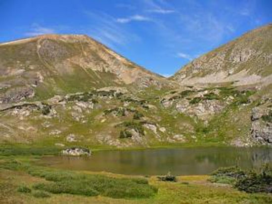
Parika Lake, Baker Pass
Activity Type: HikingNearby City: GrandbyLength: 12 total milesElevation Gain: MinimalTrail Type: Out-and-backSkill Level: ModerateDuration: 8 hoursSeason: July to SeptemberTrailhead Elevation: 8,940 feetTop Elevation: 11,253 feetLocal Contacts: Arapaho National Forest, Rocky Mountain National Forest; Never Summer Wilderness AreaLocal Maps: USGS Bowen Mountain, Mount Richtofen, Grand LakeIf you seek a more secluded route away from the weekending throngs, then head out west to the Never Summer Mountains. A moderate day hike or easy overnight trip leads you through pristine alpine environments frequented by the more intrepid hikers and backpackers in summer, and by skiers and snow-shoers in winter. Do pack those extra layers, as the Never Summers live up to their name and can be chilly at any time of year.
Driving Directions [Google Maps] Click for Interactive Map

10. Chicago Basin

Chicago Basin
Activity Type:     Hiking
Nearby City:     Needleton
Length:     16.6 total miles
Elevation Gain:     Minimal
Trail Type:     Out-and-back
Skill Level:     Strenuous
Duration:     2 days
Season:     July to September
Trailhead Elevation:     8,000 feet
Top Elevation:     12,680 feet
Local Contacts:     San Juan National Forest; Weminuche Wilderness Area
Local Maps:     USGS Mountain View Crest, Columbine Crest, Snowdon Peak
Surrounded by the spectacular 13- and 14-thousand-foot peaks of the Needle Range, Chicago Basin is the most popular hiking route in the Weminuche Wilderness area of the San Juan Forest. Nearby Durango is a 6 hour drive or 1 1/2 hour flight southwest from Denver. The narrow gauge train of the Durango & Silverton Railroad provides a truly old-world access to the trail itself – but be aware that the area can be very busy in the summer months.
Driving & Flight Directions [Google Maps] Click for Interactive Map

Andrew Murray 2015


Comments